27 Feb What are Planning Overlays?

For Town Planning in Victoria, we have zones and overlays to provide the details on planning controls for each property. These provide details on how the use and development of the land can be carried out.
Every property (except Federal land such as airports) has a zone. These zones control the types of uses that are allowed on the land and provide guidance on the preferred use for an area, for example in residential zones the preferred use is residential. You can read more details on some of the common residential zones here.
Planning overlays provide more specialised controls for specific land features such as vegetation, heritage or buildings. Planning overlays are not used for all land. They are only used when there is a special feature of the area or the land that the Council believes should be protected. Planning overlays can be quite complex. They are categorised into broad groups:
- Environmental and Landscape Overlays
- Heritage and Built Form Overlays
- Land Management Overlays
- Other Overlays
Environmental and Landscape Overlays

These overlays seek to protect vegetation or landscape features of an area. They are used to recognise areas of environmental or landscape significance and to provide guidance to land owners considering new development or works on their land. Some common overlays in this group are discussed below.
Vegetation Protection Overlay (VPO)
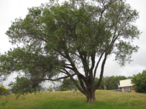
This overlay is used to protect vegetation. In some areas any vegetation removal triggers a planning permit and in other areas it is only vegetation of a certain type and/or size that need planning permission to be removed.
Significant Landscape Overlay (SLO)
This overlay is used to identify areas that have a significant character that Council wants to maintain. This overlay may also have specific design or development controls so can be similar to the Design and Development Overlay discussed below, however the intent of this overlay is to maintain the existing character of the area, whereas the Design and Development Overlay can be used to encourage a new character to the area.
Environmental Significance Overlay (ESO)
This overlay is used in areas of environmental significance or sensitivity. It commonly controls both vegetation and built form. It is more common in low density or rural areas.
Heritage and Built Form Overlays

As the name suggests, these overlays are intended to control or protect buildings or the look of the area. Some common overlays within this group are:
Design and Development Overlay (DDO)
This overlay is used to specify preferred design and/or development in an area. For example it may be used to specify the number of houses that can be built or the building height. The DDO is commonly used along the urban coastal areas for example in Mornington Peninsula Shire.
Heritage Overlay (HO)
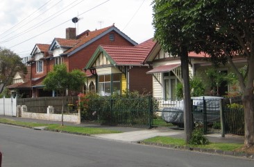
The purpose of this overlay is to identify properties that have heritage value to ensure this heritage value is protected. For example, while generally you don’t need planning permission to demolish a house, you will need a planning permit if you have a Heritage Overlay over it. Renovations and extensions can be more complex with a Heritage Overlay and you may require the assistance of a Heritage Consultant in your application.
Land Management Overlays

These overlays are used to signify land with potential issues that need managing. In many cases these overlays will require expert advice or approval from a statutory authority such as Melbourne Water for flooding or the CFA for bushfire risk.
Some common overlays within this group are:
Erosion Management Overlay (EMO)
This overlay signifies that the land may have stability issues. Generally a geotechnical report will be required to demonstrate that the development will not cause stability or land slip issues.
Flooding Overlay (FO) and Special Building Overlay (SBO)
These overlays indicate areas that may be subject to significant flooding events. Flooding can be caused by many different things such as nearby water sources, low lying areas within a flow path and drainage issues. Depending on the specific flooding issue there will be different requirements, for some developments it may be raised floor levels or setbacks of boundaries, while for other developments their may be constraints on the extent of development allowed. Preliminary advice can be obtained from Council and the relevant authority for the overlay to discuss issues and options for your site.
Bushfire Management Overlay (BMO)
The BMO identifies areas that are within proximity to a bushfire hazard. You will need a bushfire management statement and plan prepared to demonstrate how the land will be managed to minimise risk associated with bushfire. You can read more about the Bushfire Management Overlay here.
Other Overlays
As the name suggests, these are other overlays that don’t fit within any specific group. Some examples are:
Parking Overlay (PO)
This overlay is used to provide alternative car parking rates for specific land uses. It is also used to facilitate financial contributions in lieu of car parking, for example this overlay may be used in a new activity centre area to allow for contributions for car parking to be collected to provide for public parking to be provided in the area.
Public Acquisition Overlay (PAO)
This overlay is used to nominate land that may be acquired in the future. The overlay will specify which public authority the land is reserved for. A common example is land reserved for future roads or road widening, managed by VicRoads.
Development Contributions Plan Overlay (DCPO)
This overlay is another overlay that facilitates contributions to the Council. It is often used in development of a new area so that new developments collectively contribute towards the overall development of the area. A plan will be prepared to detail the necessary works etc that will be funded under the scheme as well as defining the rates of the levies to be implemented on each development. You can read more about typical contributions for developments in this post.
We offer expert planning advice to assess complex planning controls for you. If your site has one or more planning overlays we can provide advice on what the overlays mean and how it may influence your proposal.

